Like many D.C. residents, I’ve been trying to understand WMATA’s totally new Better Bus Network routes.
Every route has at the very least a new name. Some were completely overhauled. S2 is now (mostly)…D60? I couldn’t figure out any rhyme or reason to the new route numbers. So I mapped them.
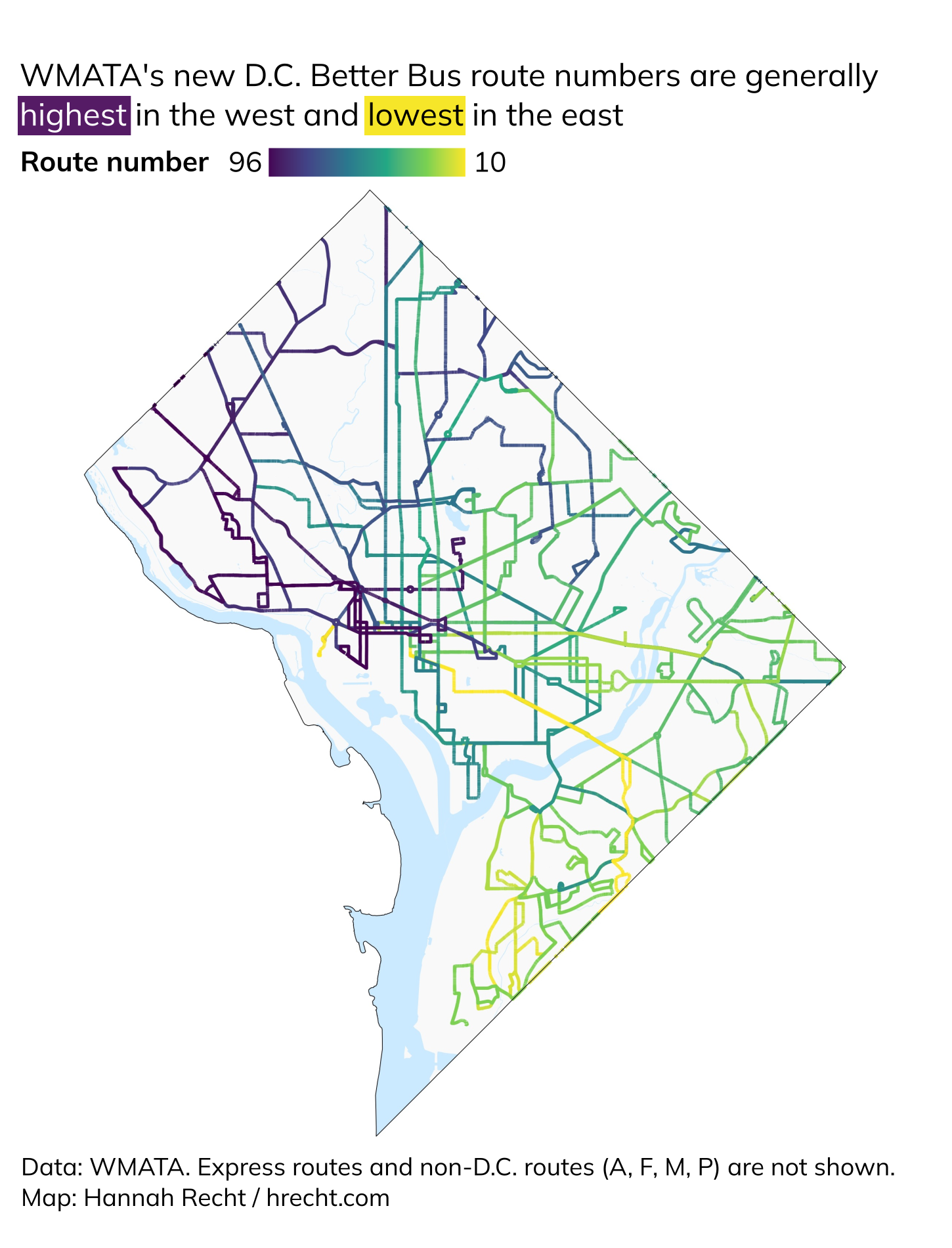
Turns out that In D.C. the routes are pretty much numbered from highest in the west to lowest in the east. A pattern! Here’s a simplified little map of the new network.
Besides the numbers, routes that are mostly in D.C. start with D for Downtown or C for Crosstown (cute.) WMATA routes in the suburbs — not shown here — start with A (Alexandria or Arlington), F (Fairfax City, Fairfax County, or Falls Church), M (Montgomery County), or P (Prince George’s County).
Tech notes: I grabbed the route data from WMATA’s API and made this quick map using tidytransit, sf, and ggplot2 in R.